Week 6 Challenge
1. Create a MicroStation rectangle, complex line and apply civil rule features to the same with linear > matchline feature definition.
Aim & Introduction
To create a MicroStation rectangle, complex line and apply civil rule features to the same with linear > matchline feature definition.
Steps & Procedure
OpenRoads Modelling => Drawing => Polygon Tools => Place Blocks
OpenRoads Modelling => Drawing => Polygon Tools => Place SmartLine
OpenRoads Modelling => Geometry => Design Elements => Create Civil Rule Feature => Feature Definition => Miscellineous => Matchline => Datapoint to accept
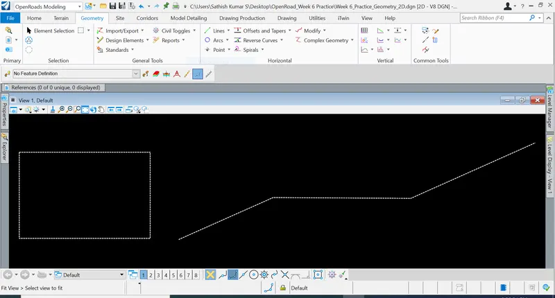
Result & Conclusion
Thus, rectangle, complex line and civil rule feature has been applied as described above.
2. Build geometry of your own parameters with geometry builder tool.
Aim & Introduction
To build a geometry of own parameters with geometry builder tool.
Steps & Procedure
OpenRoads Modelling => Geometry => Complex Geometry => Geometry Builder
Choose Line, Arc or spirals with the bearing to design the alignment.
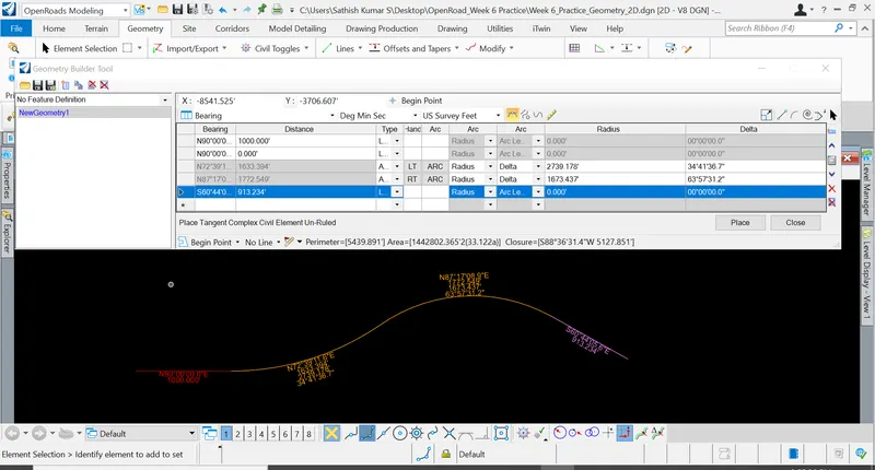
Result & Conclusion
Thus, a geometry has been built using geometry builder tool.
3. Design an alignment on the 1st intersecting street. Design the proposed profile for the same. Name the alignment as “INT_01” and “PGL_INT_01”. Assign stationing starting from start of the alignment with 50+00.
Aim & Introduction
To design an alignment on the 1st intersecting street. Design the proposed profile for the same and to name the alignment as INT 01 and PGL 01. Assign stationing starting from start of the alignment with 50+00.
Steps & Procedure
OpenRoads Modelling => Home => Attach Tools => References
OpenRoads Modelling => Geometry => Complex Geometry => Define by Best Fit
OpenRoads Modelling => Geometry => Arc Between Elements => Simple Arc
OpenRoads Modelling => Geometry => Standards => Set Feature Definition
OpenRoads Modelling => Geometry => Modify => Start Station
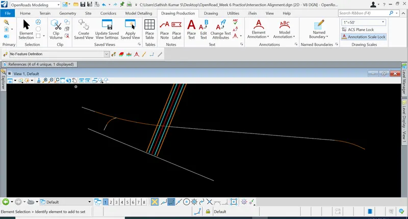
Result & Conclusion
Thus, the alignment has been designed as per the requirement mentioned.
4. Design the roadway layout for this intersecting street till the survey/topo limits. Use above alignment as a starting point. Refer to the parameters from week 5 challenge # 01, 02. Create driveway and intersection openings referring to the background imagery.
Aim & Introduction
To design the roadway layout for this intersecting street till the survey/topo limits.
Steps & Procedure
OpenRoads Modelling => Geometry => Offsets & Tapers => Single Offset Entire Element
OpenRoads Modelling => Geometry => Offsets & Tapers => Variable Offset Taper
OpenRoads Modelling => Geometry => Arc Between Elements => Simple Arc
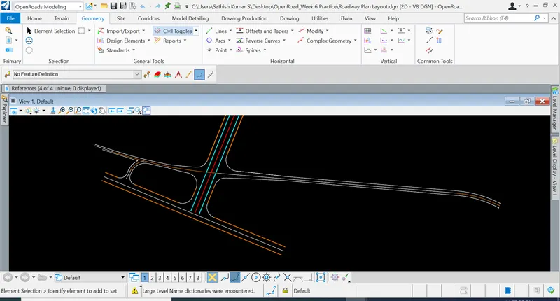
Result & Conclusion
Thus, the design of the roadway layout for this intersecting street till the survey/topo limits has been done.