Week 4 Challenge
1. Aim:-Create a terrain model by different methods using different types of raw data.
(a) From Graphics:-
Procedure:-In Terrain Model through Graphics, first we have to open a seed 3D blank Dgn file.Now we have to attach a reference file (i.e.3D survey gaphics a Dgn file) with interactive method to create terrain by them.Now Click on Terrain tool bar and select from Graphical filter where we have to create a filter group in which we create two or more filters namely spot,breaklines,voids etc.Go to filter and add filter through levels as given by the surveyor one by one.Next add them in filter group and finish.Now we go to main menu again create terrain from Graphics and add filter group with filters.select existing triangles as feature defination and named terrain by graphics as well.Right click to accept and shown the existing triangles.On and Off the reference display to see clearly the traingles from spots and breaklines formed uniformly.
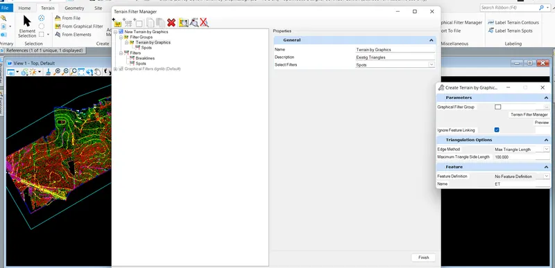
:-Plz see the attachment
Result:-Hence we can see the final existing traingles through graphical filters using raw dgn file(3d survey graphics).
(b) From Element:-
Procedure:-Another Important method to create terrain model Is element seletion.At First We have to open a seed 3D-blank Dgn file and attach a reference file i.e.3D survey gaphics with interactive method to create terrain.Now Select the element using element selection tool bar (by element or level)i.e Cell,Line string,Line.Then select contour as feature type and existing triangles as feature defination from Element tool bar.Finally accept the selection from element and click ok to generate traingles by them.Another method to select element,we used the level displayand choose only the Sv point to create the traingles,taking feature type "spot" and feature defination existng traingles .We can also add fetaure i.e voids by selecting triangles using flyout menu and remove feature which one was added earlier,If required.
:-Plz see the attachment
Result:-Hence we can obtained the existing traingles by element selection tool bar and also select the element through level display to create trinagles by them.
(c) By text Interpolation:-
Procedure:-As the name imlies that this process is based upon the selection by text to create triangulation.The process is same using blank 3D dgn file with a referece attached 3D graphics with interactive method.Go to level display,and "ON" only major and minor contors through which we can filter them as linear and text one by one through element seletion in filter manager tool bar as done in earlier methods by filter.Now select filter and finally accept data point with feature defination and ok.
-Plz see the attachment
Result:-Hence we can obtained the contours, traingles by text interpolaion method using filter function as well.
2. Aim:-Edit the terrain model as we created earlier.Aim is to How the editing tools work for handling terrain removed bad spots.
Procedure:-Here first of all we have to open blank seed 3D dgn file and import TIN file to Edit the terrain model.In edit tool bar we can add and delete vertex,delete edge traingle,Swap line from one side to another,Move vertex and most Important delete feature if any add earlier such as pond or any spots as well.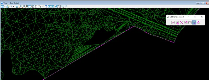
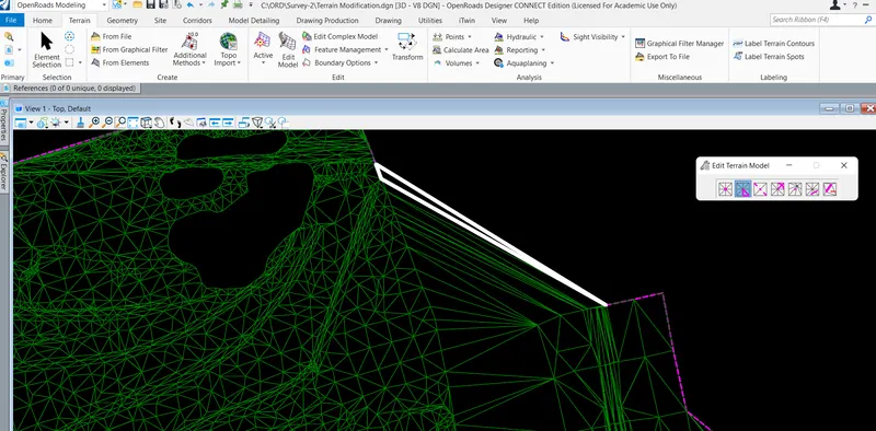
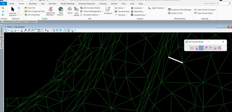
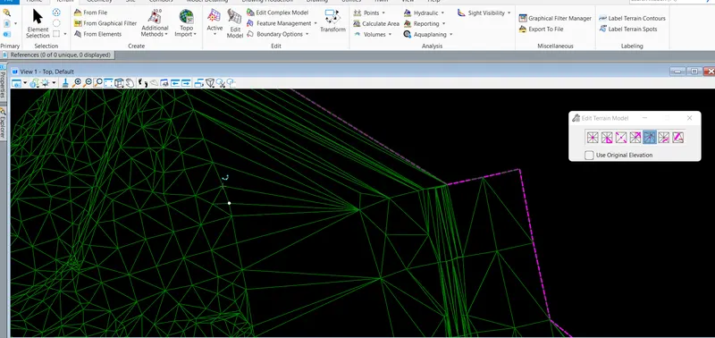
:-Plz see the attachment
Result:-Hence we can Edit the terrain model traiangles as per need by editing tool.
3. Aim:-To change the contour interval
Procedure:-To change the interval of contour first we have to click on the properties and go to properties menu bar,Now go to calculated feature and see both the contours major and minor as well.here from there we can change the interval of these contours as per need.
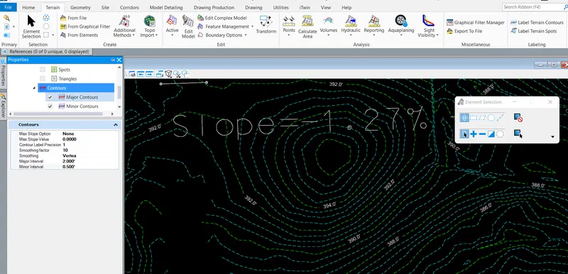
:-Plz see the attachment
Result:-Hence we can Edit the the contour intervals by properties menu bar or flyout tool as well.
4. Aim:-To annotate the contours with lebel
Procedure:To annotate the cotours label first we have to go through label terrain contous bars in labeling setion.Now click on this tool and set the annotation mode All contours and text alignment as per need follow line or Up-slope.in follow line text value follows the contour lines while in up-slope it shows only slope value.But the process is same.we can also edit or delete the annotate value on doble click upon the text.
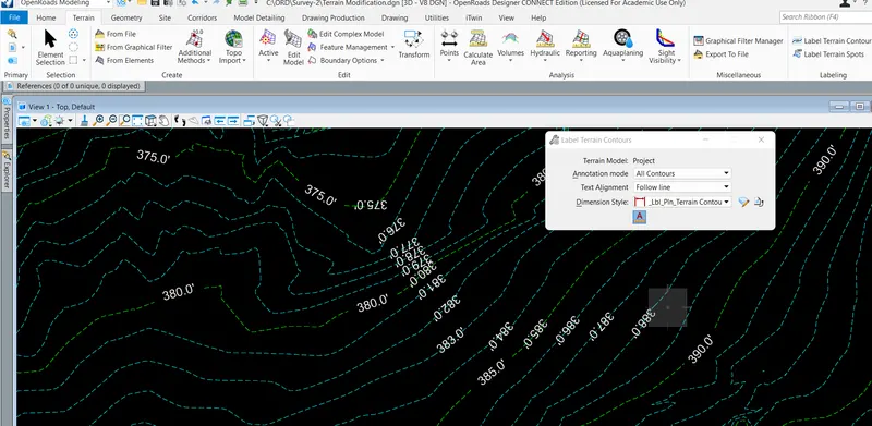
:-Plz see the attachment
Result:-Hence we can set the annotate values by labeling the contours elevations by follow the line of labeling processs.