Usage of Navigation tool , Timeliner and Clash Detection test using Naviswork
USAGE OF NAVIGATION TOOL, TIMELINER AND CLASH DETECTTION TEST USING NAVISWORKS
INTRODUCTION:
Autodesk Naviswork is a software control model for architects, engineers and building designers. The simulation software improves your Building Information Modeling (BIM) and assists you with professional workflows and design methods. Collision and design conflicts are indicated at an early stage to give you assurance at all times. With Autodesk Naviswork , you keep all-round control over your building project. Check your plans, simulate new ideas and use photo-realistic representations of your designs for perfect presentations.
Navisworks is built around a core module called Roamer and has a number of built-in functionalities:
- Roamer - The core part allows users to open models from a range of 3D design and laser scan formats and combine them into a single 3D model. Users can then navigate around the model in real-time and review the model with a range of mark-up tools.
- Publisher - This allows users to publish the complete 3D model into a single NWD file that can be freely opened by anyone using Freedom, a free viewer.
- Clash Detective - A functionality to enable interference detection. This means users can select parts of the model and look for places where the geometry conflicts. This is for finding faults in the design.
- Renderer - With the Renderer, users can apply materials and lighting to the model and produce photorealistic images and animations.
- Quantification - By "taking off" the model, users can automatically make material estimates, measure areas and count building components.
- TimeLiner - Adds 4D simulation so the user can link geometry to times and dates and to simulate the construction or demolition of the model over time. Also links with project scheduling software (Such as Microsoft Project or Primavera products) to import task data.
- Animator - A feature that allows the users to animate the model and interact with it.
- Scripter - This allows the user to set up a collection of actions that he/she want to happen when certain events conditions are met.
Autodesk Navisworks Simulate allows you to check models in three dimensions and integrate even large data sets into a central coordinate model. With 5D analysis and a wide range of simulation functions, you can achieve perfect construction planning at any time, including the associated construction site logistics and safety planning. Use the extended possibilities for optimized collaboration between all project participants, for example, by checking and adjusting designs simultaneously.
Autodesk Navisworks Manage bundles a variety of powerful tools for planning, simulation and validation of BIM Projects. Reduce errors and potential risks early on - even for projects with spatial complexity. In addition to simulating, analyzing and quantifying projects, Navisworks Manage allows you to easily integrate and seamlessly process them with Autodesk Construction Cloud and Revit.
BENEFITS:
- Simplify collaboration between all involved teams. Share views with all participants and quickly and simply exchange data on an open 3D model.
- Easily optimize results, even without in-depth CAD skills. Use tools to measure, markup, comment and visualize your project in real time.
- Perfect presentations and show off your project in the best possible way. Early-stage simulation of time and planning processes as well as potential collisions. You can then create error-free designs and present them in the shortest possible time at the "push of a button".
AREAS OF APPLICATION:
- Collision check: Use Navisworks to automatically detect conflicts in the planning data of all participants. The software detects, for example, when a hole for a pipeline is missing. An automatically generated report then notifies the relevant building partner.
-
COST CALCULATION: Calculate accurate quantities and associated costs. Utilize all available data such as simple 2D floor plans and complex BIM models.
-
BUILDING PROCESS SIMULATION: Fully simulate project progress. Use the results to check building progress.
1) Use the Architecture/ Structure Project file developed by you in Week 6 to 8. Export the Revit architecture and structure model to Navisworks Cache file following the export settings discussed in class
Aim:
To export the Revit architecture and structure model created in week 6 challenge to Navisworks Cache file following the export settings.
Procedure:
- Initially Open the Autodesk account and download the Naviswork Manage software.
- Now, open the Architectural model created in week 6 challenge in the Revit software.
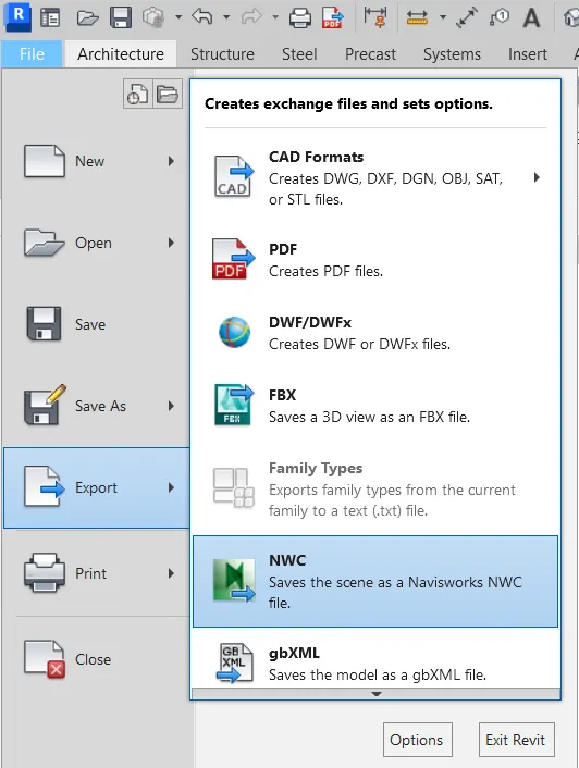
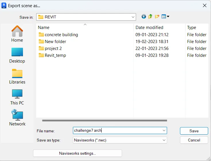
- Then go to File - Export - NWC file.
- Now, save the file and the file is exported.
RESULT:
The Architectural and Structural model is exported to the Navisworks.
2) Use Navigate Tool to walk around the model and walk through the rooms created and record your moving as animation in your Navisworks file
Aim:
To use navigate tool to walk around the model and walk through the rooms created and record your moving as animation in your Navisworks file.
Procedure:
- Initially open the architecture file in the Naviswork.
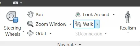
- Now, go to walk option in the viewport tab of the Naviswork software.
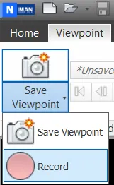
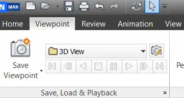
- Use the record option in the save viewport option to record animated view of each and every room.
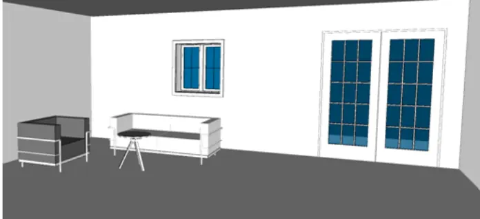
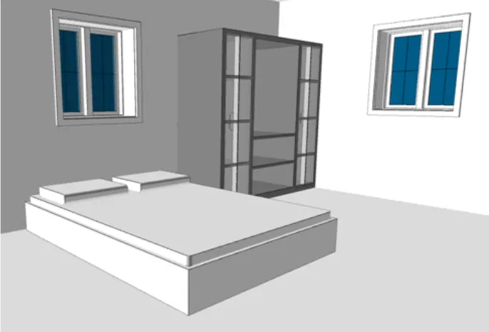
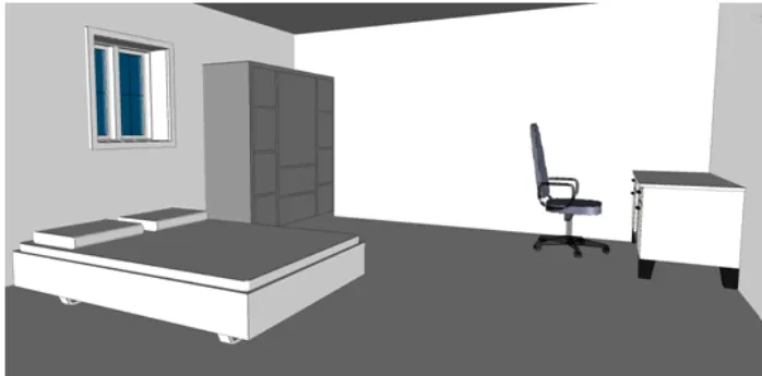
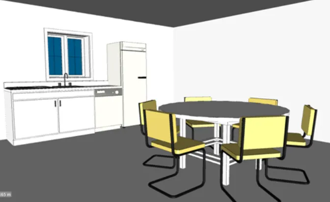
- Living room, Bedroom and kitchen are done walk through.
- Hence, Walk through the building is completed.
RESULT:
By using the Navisworks walk around the model is completed.
3) Use Navigate tool to use Realism feature to walk through the model and record your moving as animation in Navisworks file
Aim:
To use Realism feature to walk through the model and record moving as animation in Navisworks file.
Procedure:
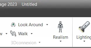
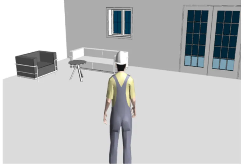
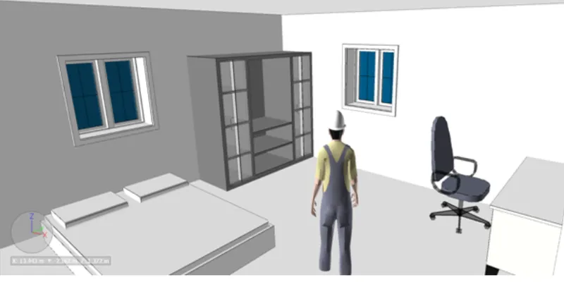
- In the Naviswork software under the Viewport tab go to Realism and in realism click on third person.
- Now, again record the moving from save viewport option.
- Living room, Bedroom, kitchen and Entrance are done walk through.
- Hence, the realism walk around is completed.
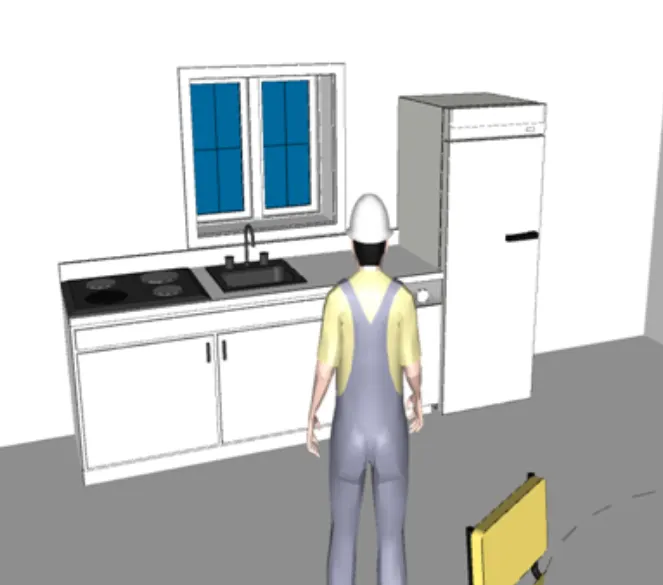
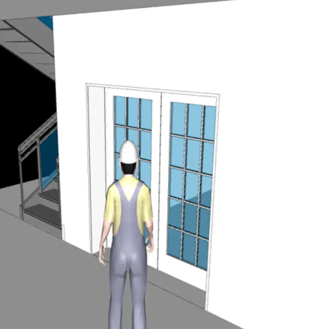
RESULT:
By using the Navigate tool Walk through the model using Realism is completedly successfully.
4) Embed both architecture and structure *.nwc file to your Navisworks file. Create a clash detection test between the two models
a. Run the Clash Detection Test
b. Study the clashes between the two models
c. List which of the clashes could be approved
d. List which of the clashes could be neglected ( will be taken care later)
e. List which of the clashes can be resolved
f. Save the results after color coding the clashes to the Navisworks file
g. In case of resolution annotate the clash and save the view to defined views in Navisworks
Aim:
To create the clash detection test between the two models.
Procedure:
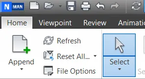
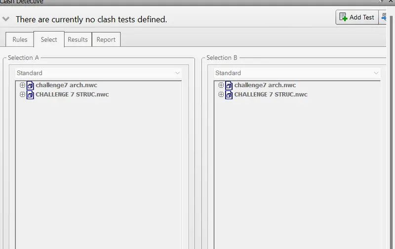
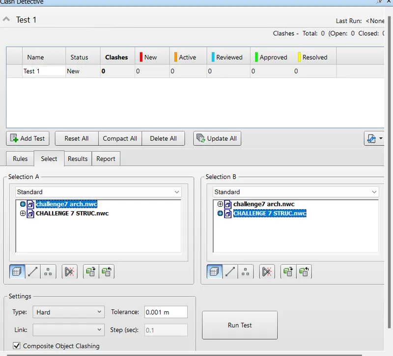
- Initially append the structural model to this architetural model.
- Then go to home tab and in that choose clash detective icon.
- Study the clashes between two models.
- List which of the clashes could be approved
- List which of the clashes could be neglected ( will be taken care later)
- List which of the clashes can be resolved.
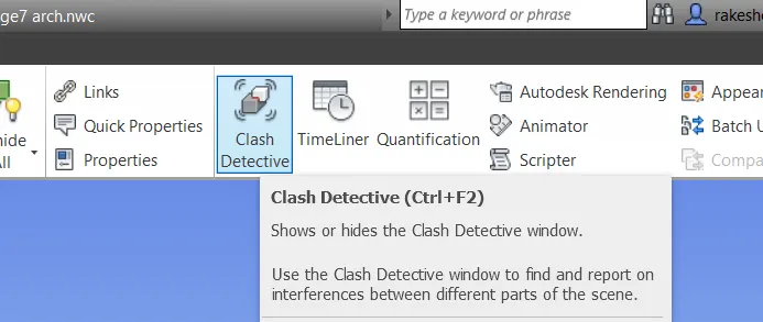
RESULT:
The Naviswork clash analysis have been successfully carried out.
5) Using the Timeliner feature in Navisworks prepare a schedule for the project developed in week 6 to 8 by adding reasonable assumptions for task start date and end date and simulate the task completion as a visual simulation. Record it and save the timeline simulation to Navisworks file
Aim:
To use the Timeliner feature in Navisworks to prepare a schedule for the project developed in week 6 to 8 by adding reasonable assumptions for task start date and end date and simulate the task completion as a visual simulation.
Procedure:
- Initially open the structural model in the revit.
- Then go to file menu - Export - NWC file
- Now, open the structural model in Naviswork software
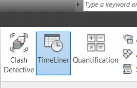
- Now, go to Timeliner in the home tab.
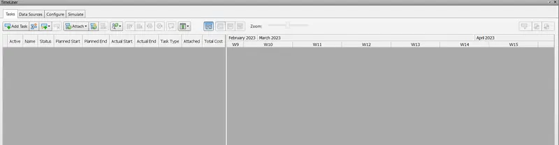
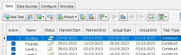
- Click add task option available in the Timeliner to add new tasks.
- Next we have to update the planned and actual dates and provide type (construct).
- Click on simulate and record it and save the work.
RESULT:
Timeliner feature in the navis work has been successfully completed.