Week 5 Challenge
Question-1:
1. Create a MicroStation rectangle, complex line and apply civil rule features to the same with linear > matchline feature definition.
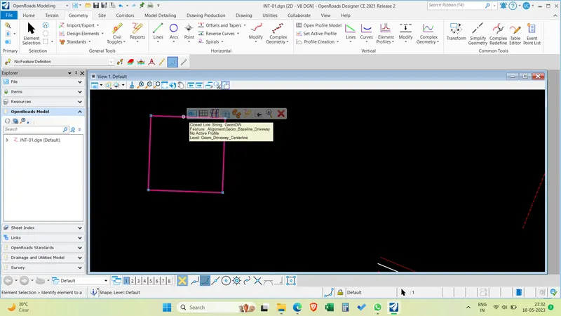
Answer: Draw a microstation rectangle in the drawing tab and apply feature definition by selecting set feature definition > Linear > Any feature definition.
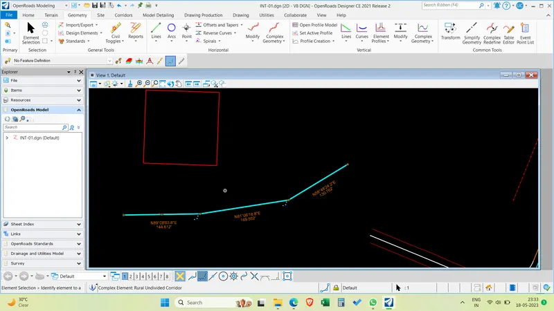
Draw lines and convert them into complex line and set feature defintion.
Question-2:
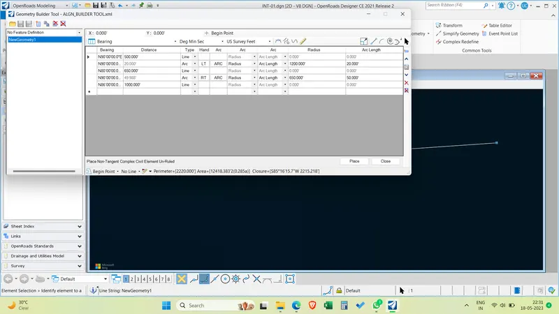
2. Build geometry of your own parameters with geometry builder tool.
Answer: Go to complex geometry > Geometry builder tool > start building alignment > Select new alignment > Select Line > enter the distance > enter > add curve and select arc > give radius > select left or right > give transition > insert lines or curves or spirals in between the alignment elements. Save the alignment as a xml file.
Question-3:
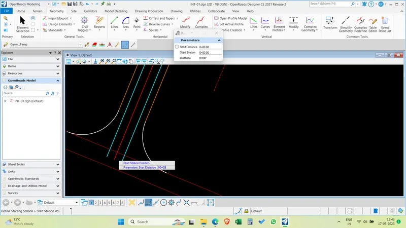
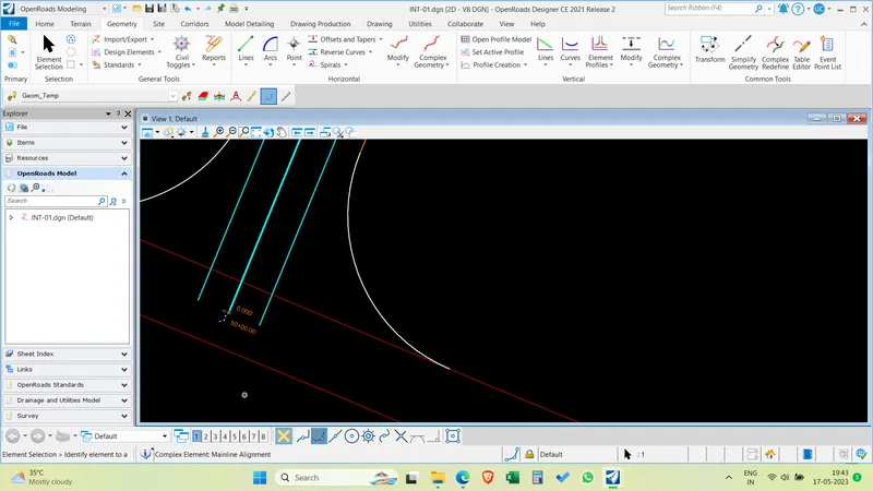
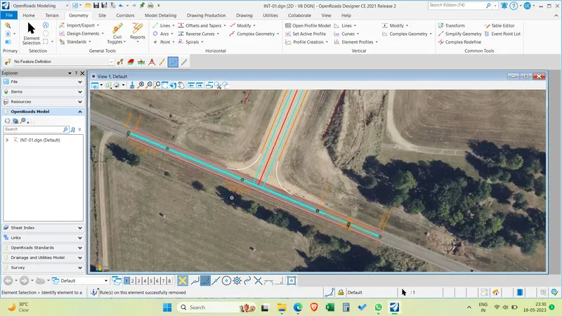
*Design an alignment on the 1st intersecting street. Design the proposed profile for the same. Name the alignment as “INT_01” and “PGL_INT_01”. Assign stationing starting from start of the alignment with 50+00.
Answer:
Question-4:
*Design the roadway layout for this intersecting street till the survey/topo limits. Use above alignment as a starting point. Refer to the parameters from week 5 challenge # 01, 02. Create driveway and intersection openings referring to the background imagery.
Answer:
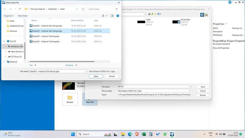
Create a new file using the imperial 2D site design seed.
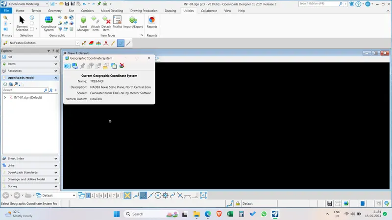
Select the GCS TX83 - NCF
Attach the reference of ROW proposed and ROW existing to the design file.
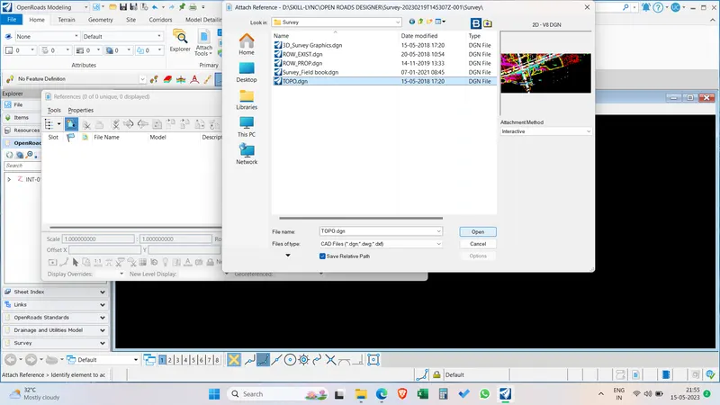
Attach the Topo drawing and turn off the level spots by right clicking on the topo.
Check the topo and aerial imagery to match the existing features and give the correction factor of
Go to Level display and Select levels to display like the E-Road_pavement edge, Gravel edge,Pavement center of road crown.
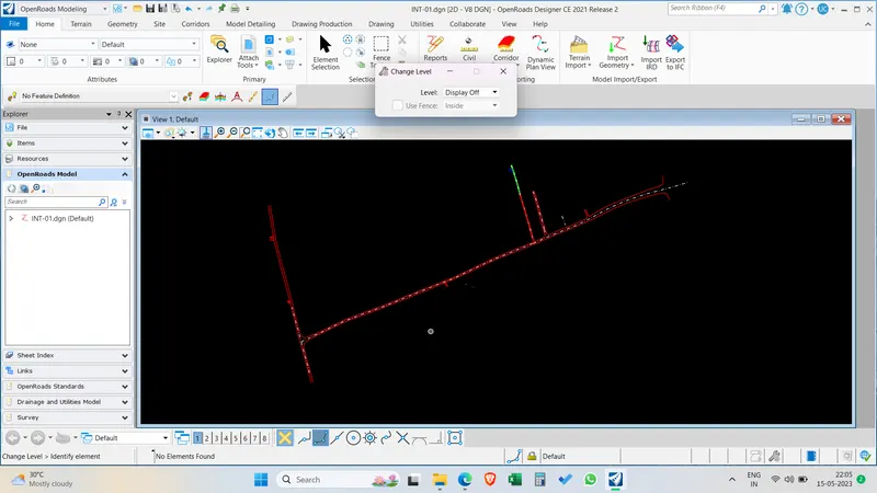
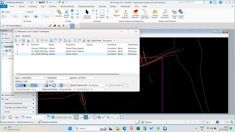
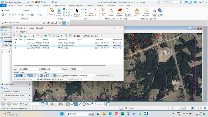
Select and copy the ROW lines
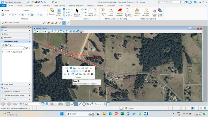
Set feature defintion > Geom_Temp.
Select Geometry > Define by best fit > Complex by edges > Select the ROW lines on either side of the road.
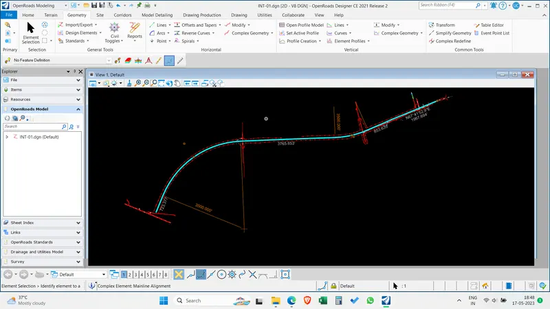
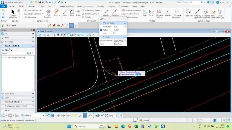
Now select the simple curves to make an alignment between two points . Select the first tangent and second tangent and give radius to fit the curve within the ROW limits and trim both.
Insert curves between tangents and complete the alignment and Create a complex geometry by select all the lines and curves in a sequential order and assign a feature definition after the single complex line is formed.
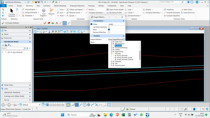
Now select the offsets and tapers and offest the alignment to 12 feet on either side and assign them road edge shoulder feature definition.
Alignement is completed for Mainroad now we have to develop intersections.
Intersections :
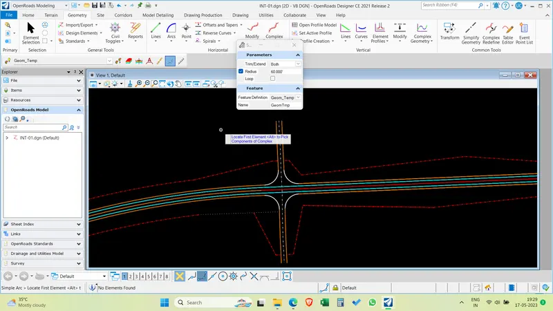
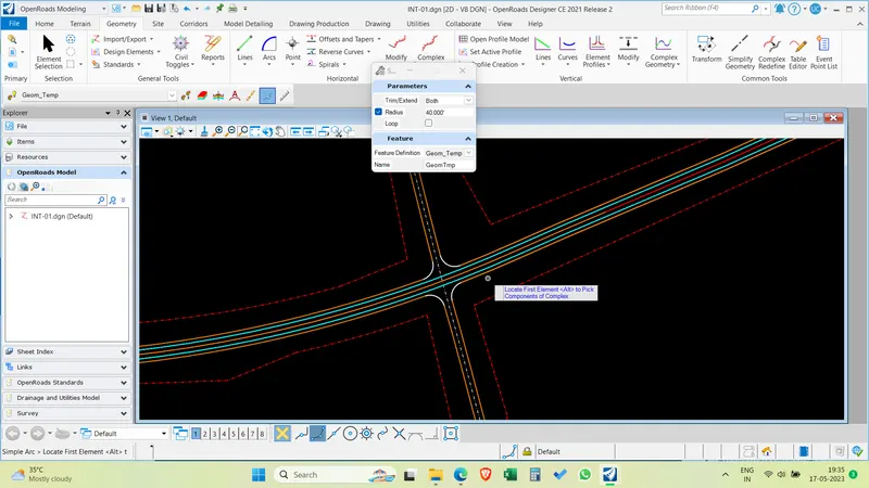
Select the first intersection > Repeat the best fit option and offset to 12 feet either side.
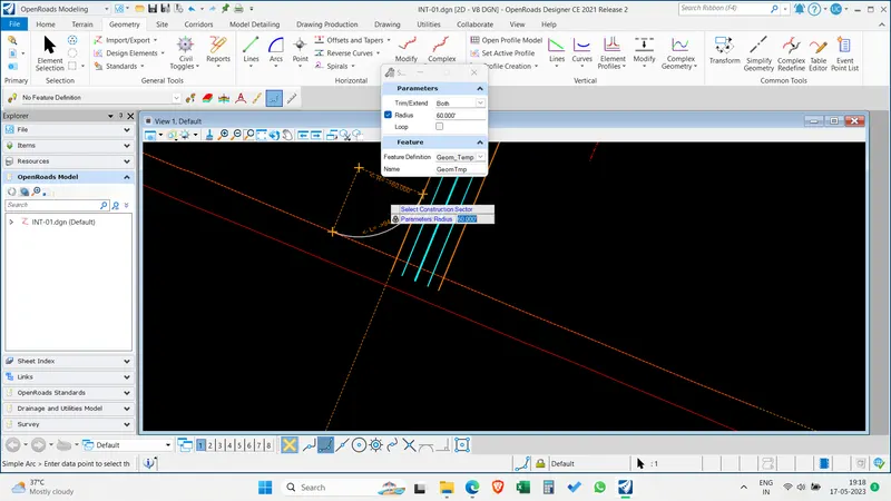
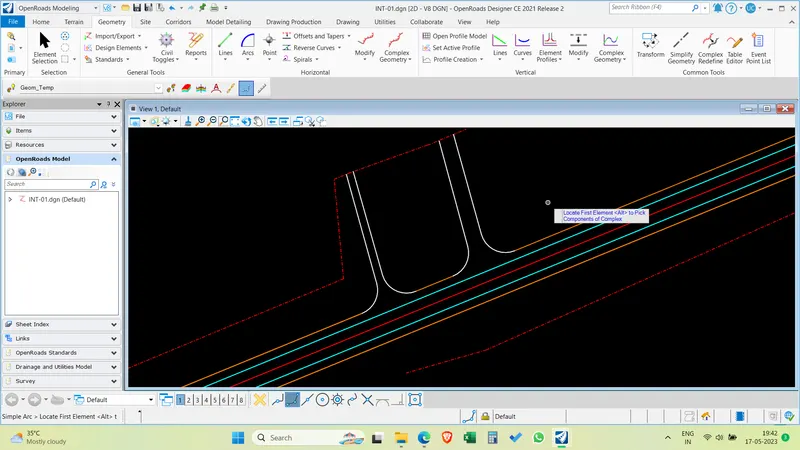
Insert simple curves between road shoulder and intersection shoulder with 60 feet radius on either side of intersection.
Assign geom temp feature definition.
Repeat this for all the existing roads joining with the alignment.