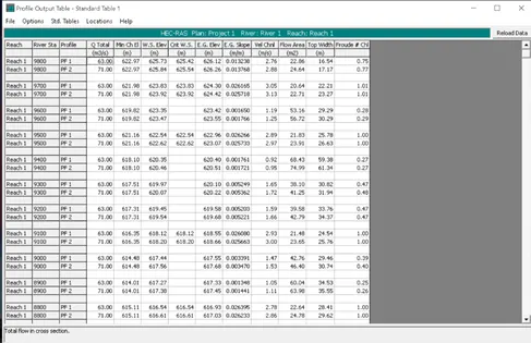
Project 1
Project 1
Objective:
Develop a hydraulic model for a major river from your area without considering any obstruction in water course
Tools used:
AutoCad
Excel
Google Earth Pro
Procedure:
DOWNLOADING TOPOSHEET
Step 1:
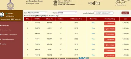
Download toposheet from SOI website
https://soinakshe.uk.gov.in/mtr/Manchitra_MTR.aspx
GEOREFERENCING USING QGIS
Step 2:
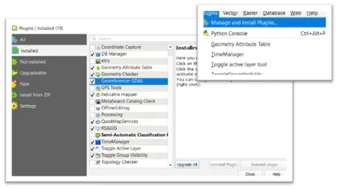
Georeferencing in QGIS is done via the ‘Georeferenced GDAL’ plugin. This is a core plugin - meaning it is already part of your QGIS installation. You just need to enable it.
Go to Plugins ‣ Manage and Install Plugins and enable the Georeferencer GDAL plugin in the Installed tab. See Using Plugins for more details on how to work with plugins.
Step 3:
- The plugin installed in the Raster menu.
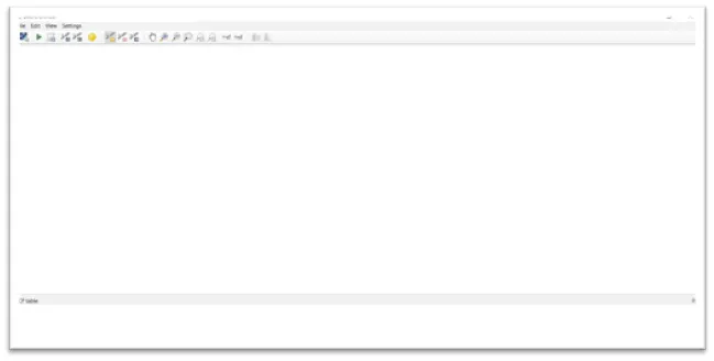
- Click on Raster ‣ Georeferencer ‣ Georeferencer to open the plugin.
- The plugin window is divided into 2 sections.
- The top section where the raster will be displayed.
- The bottom section where a table showing your GCPs will appear.
Step 4:
Now open ‘JPEG’ image.
Go to File ‣ Open Raster.
Browse to the downloaded image of the scanned map and click Open.
Step 5:
In the next screen, you will be asked to choose the raster’s coordinate reference system (CRS). This is to specify the projection and datum of your control points. If you have collected the ground control points using a GPS device, you would have the WGS84 CRS. If you are geo-referencing a scanned map like this, you can obtain the CRS information from the map itself. Looking at the map image, the coordinates are in Lat/Long. There is no datum information given, so we have to assume an appropriate one. Since it is India and the map is quite old, we can get the ‘Everest 1830’ datum, would give us good results.
Step 6:
Now we need to assign coordinates to some points on this map. If you look closely, you will see coordinate grid with markings. Using this grid, you can determine the X and Y coordinates of the points where the grids intersect. Click on Add Point in the toolbar.
Step 7:
In the pop-up window, enter the coordinates. Remember that X= Longitude and Y= Latitude. Click OK.
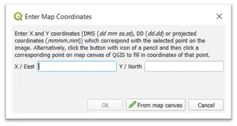
Step 8:
You will notice the GCP table now has a row with details of your first GCP.
Similarly, add at least 4 GCPs covering the entire image.
The more points you have, the more accurate your image is registered to the target coordinates.
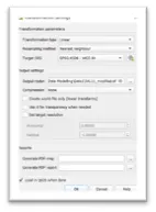
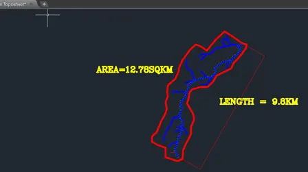
ADDING TOPOSHEET IN AUTOCAAD TO CALCULATE RIVEN REACH LENGTH AND CATCHMENT AREA
Step 12:
Open the saved Georeferenced image into auto cad

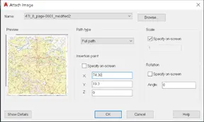
Step13:
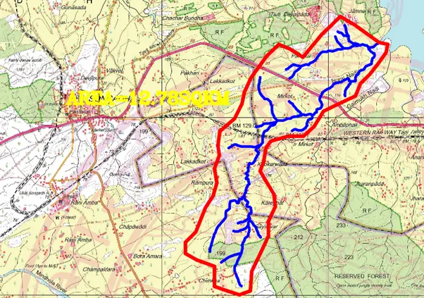
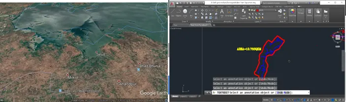
Using poly line command in AutoCAD mark the selected river and catchment boundary
Using Google earth pro take note of latitute, longitude and elevation.
Step14:
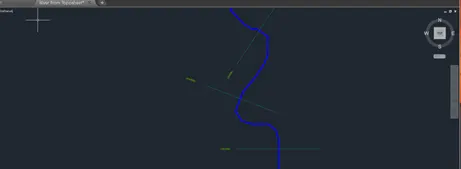
Mark the chainage use LISP tool in autocad for the selected river
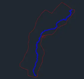
Using massprop command in Autocad we can find Lc
UNIT HYDROGRAPH FLOW CALCULATIONS
Step15:
Add necessary value in excel and with reference of flood modelling manual for the basin
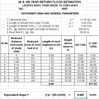
Step16:
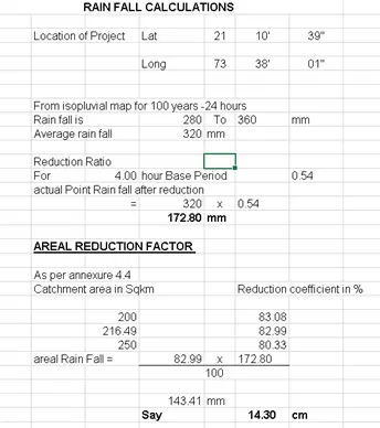
Rainfall Calculations
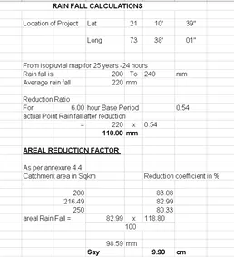
Step17:
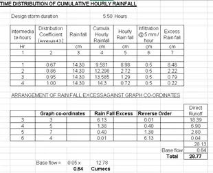
Time Distribution Cumulative hourly rainfall calculations
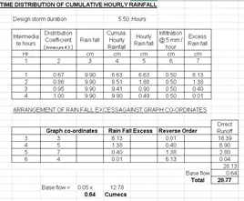
Step18:
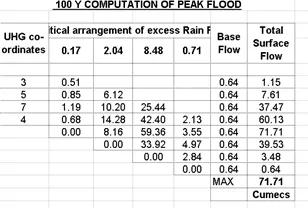
25 years peak flood computation
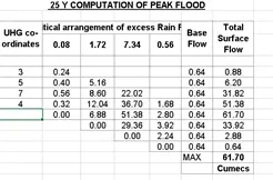
Step19:
Similarly peak flood for 100 year is also calculated
Reference :
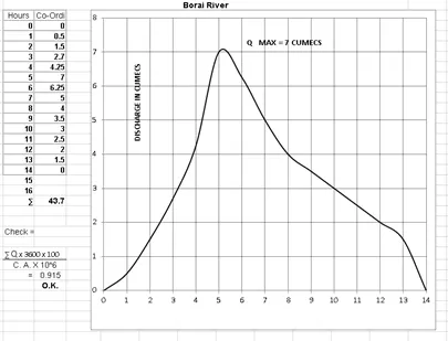
Synthetic Unit Hydrograph
STEADY FLOW ANALYSIS
Step 20:
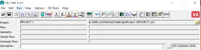
Start new project to your respective location
Step 21:
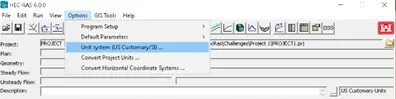
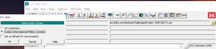
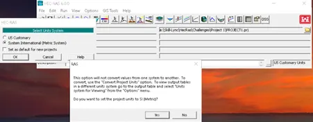
Change the unit system to SI system.
Step 22:
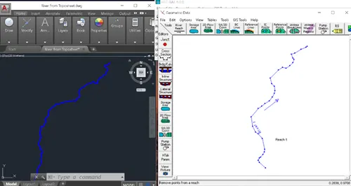
Open Geometric editor with the help of river reach tool, draw the selected river of your area.
Step 23:
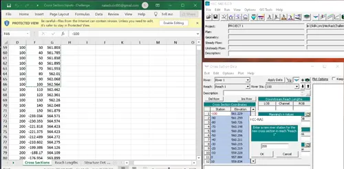
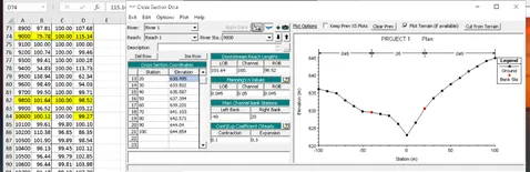
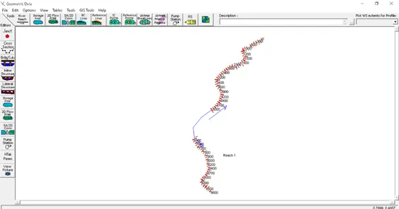
Add the cross-section details respective to your river or from the data provided with manning’s constant, river reach and bank station.
RUNNING MODEL WITH DIFFERENT PLANS
STEADY FLOW ANALYSIS
Step 24:
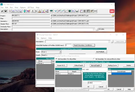
Add steady flow data with the calculated value.
Step 25:
Compute the steady flow simulation with plan
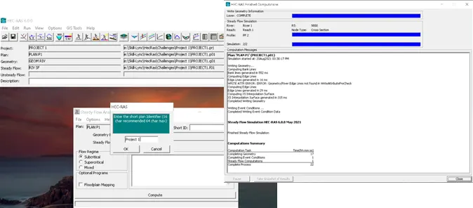
Step 26:
Visualize the results
XYZ Perspective plot
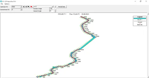
Cross Section Output
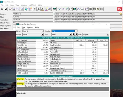
Profile Output