Creation of geometries by Coordinate system methods using AutoCad
Aim:-
- Create the geometries from P1 to P2 using all the coordinates system methods. You need to use the Line tool to create the geometries. Where required you need to use the circle tool.
- Civil Related Problems
Draw the profile and the trusses using any coordinate system methods. The dimensions are there for references.
Introduction-
In autocad we have foure method to draw the geometry on autocad.
1) Absolute Coordinate system.
2) Relative Rectangular Coordinate System.
3) Relative Polar Co-ordnate System.
4) Direct Distance Entry.
There are two coordinate system in autocad as shown below
1) Polar co-ordnate system
2) Cartesian co-ordinate system.
- Polar Coordinates: Polar coordinates are used when you need to draw the next points at a specific angle. Polar coordinates system in AutoCAD specifies distance length at which angle. Using polar coordinate points entered by typing @distance
- Cartesian coordinate: A Cartesian coordinate systemis normaly used to measure the distance. And it has three axes, X, Y, and Z. When you enter coordinate values, you indicate a point's distance and its direction (+ or -) along the X, Y, and Z axes relative to the coordinate system origin (0,0,0).
- Absolute Coordinate system:- In this system. draw the object to the fixed point of origin (0,0)
- Relative Coordinate system :- In this system. draw the geometry of object to the previous point of origin.
Procedure:-
1) click an autocad icon. And open it
2) choose autocade template file as per instruction (imperical,metric).
3) use the command what you want to draw the geometry.
4) type the point as per requirement of geometry.
5) Repeat the process till the end of geometry.
6) After complition of goometry. do proper detailling.
Practice Problem
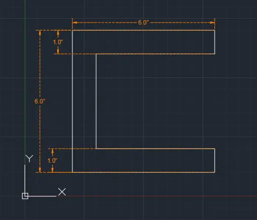
P1
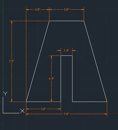
P2
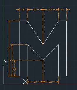
P4
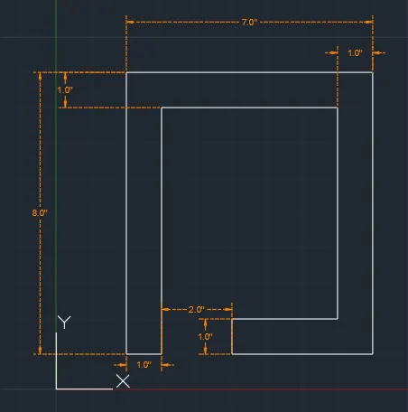
P5
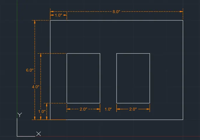
P7
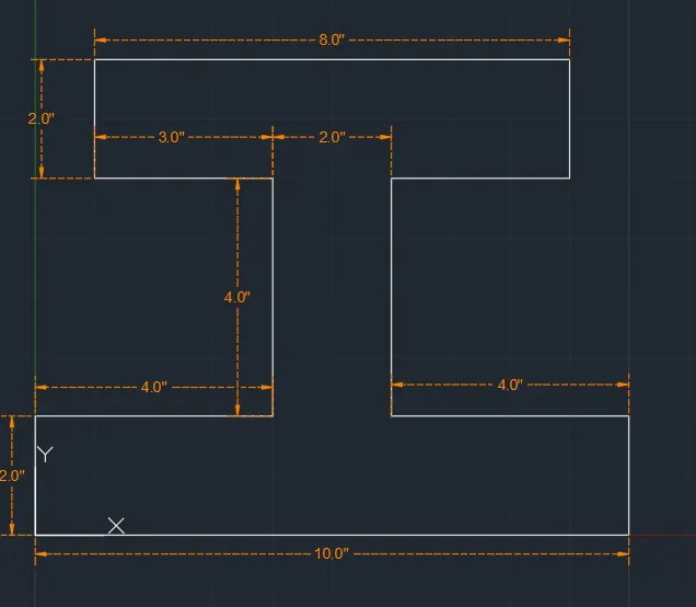
P8
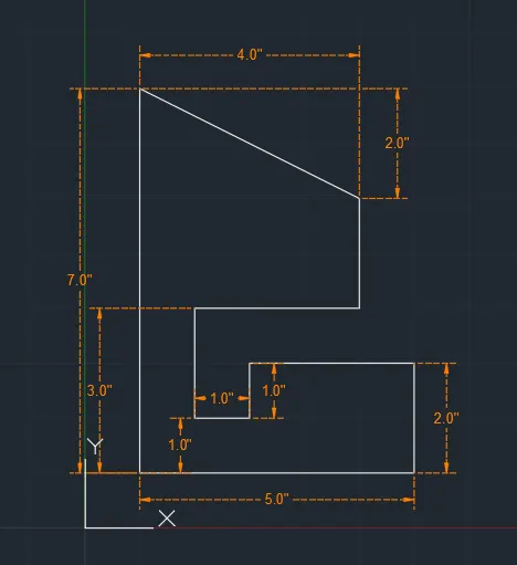
P9
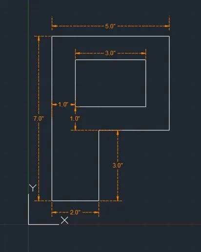
P10
Civil Related Problems:-
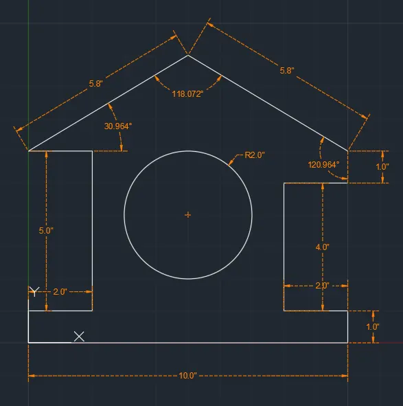
Profile Wood
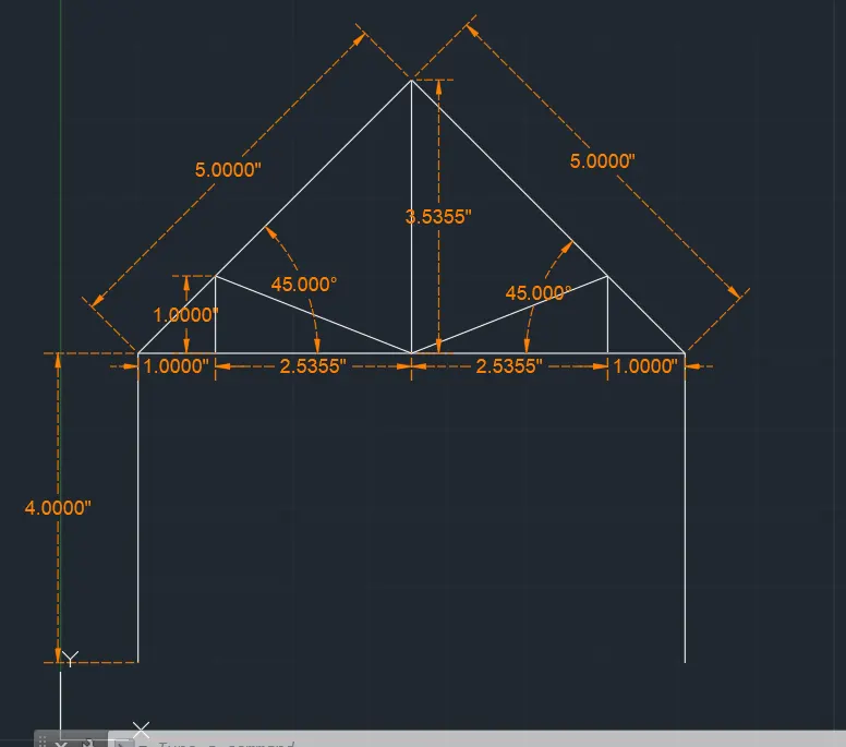
Queen Post truss
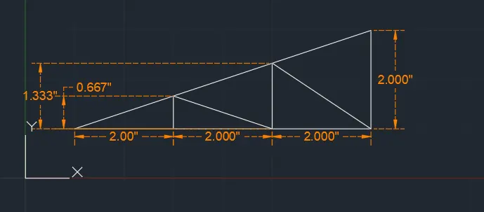
Mono pitch
Result:- I have to use autocade software to draw all the geometry as per given instruction. as shown above. By using polar and cartesian co-ordinate system.